
From the rugged peaks of the Southern Alps to the remote valleys of Fiordland, New Zealand's South Island offers you the opportunity to enjoy some of the world's most spectacular hiking adventures. But to do it safely you need to know exactly where you’regoing and what to expect along the route - and that means having a detailed map. At Outside Sports we’re big fans of being well prepared and to back up your phone navigation app, we think it’s very wise to take along a printed Topo50 topographic map as well. They won’t break if you drop them and they will never go flat (because they're already flat 😂)
Why a Topo50 Printed Map is Essential Kit For South Island Adventures
There's a Topo50 Map For Every Adventure
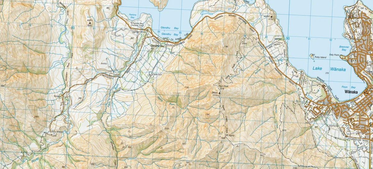
We stock the Topo50 maps range that’s produced by Land Information New Zealand (LINZ) the government agency responsible for mapping New Zealand. Topo50 maps use a practical 1:50,000 scale, where one centimetrerepresents500 metres on the ground. Topo50maps use the NZTM2000 projection and NZGD2000 datum, which aligns with modern GPS technology.
Topo50 maps show contour lines, rivers and river crossings, ridgelines, cliffs, tracks, huts, roads and other important features, that will helpingyoubetter understand the terrain you’retravelling through. Map reading is a skill that’s very much worth developing as a hiker, distance trail runner or mountain biker.Unlike passively following a line on a phone screen, reading a topographic map encourages you to understand the landscape. You can identify steep climbs, plan alternative routes, estimate distances, locate water sources, and spot landmarks. Combined with a compass and the skills to use it, a map is an invaluable navigation tool – and is an excellent flex in the evening in the hut.
A Fail-Safe Backup When Technology Fails
Smartphone navigation apps are fantastic, but they're not infallible. Batteries go flat, phones get wet, or damaged, and GPS reception can be unreliable in deep valleys. Your online maps might also become inaccessible without mobile coverage - unless you’ve remembered to download them beforehand.
A printed Topo50 map doesn't need batteries, reception or software updates. Kept in a waterproof map case, it's a dependable backup when technology lets you down.
A Lasting Reminder of Your Backcountry Adventure
There's also something special about a well-used paper map. Mark your route, record campsites, note memorable viewpoints, and add dates. Afterwards, your map becomes a tangible record of your adventure, complete with memories no smartphone screen can quite replicate. You could even frame it and put it up on your wall.
The Right Topo50 Maps For Your Next Mission Are At Outside Sports
Get the Topo50 map range at Outside Sports - available in our stores throughout the Southern Lakes region, and also online, covers every adventure zone in the Southern part of the South Island.
Your Hiking, Climbing, and Bikepacking Gear Specialists
Nobody in Australasia comes close to the range of premium outdoor adventure brands that we stock all under one roof at Outside Sports.